Research programs
Visual analytics
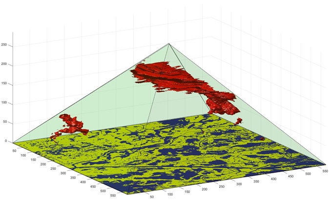
This project aims to address the long-standing challenges of multi-scale spatio-temporal analysis in GIS. This research goes beyond the traditional representations of space (flat layers) and time (linear view), and build new data models and analytical tools based on the Triangle and Pyramid Model. Our goal is to detect and measures patterns and relationships across spatial and temporal scales.
Geospatial Big Data
With the emergence of Web 2.0, social media networks are becoming platforms where numerous users can publish and exchange information at any time in any place. In social media, every user acts as an intelligent sensor that collects and shares information about their surrounding environment. I'm currently working on projects that leverage social media data to understand human dynamics in natural hazards and climate change.
Disaster vulnerability and resilience

We leverage various types of geospatial data (e.g. remote sensing images, social media data and traffic data) to monitor human dynamics in disasters. We then develop quantitative models to associate the observed recovery trajectories of communities with various socio-economic factors. A suite of analytica methods and tools are developed to assess community resilience in various disasters and various spatio-temporal scales.
Dynamic Modeling of Coupled Natural and Human Systems
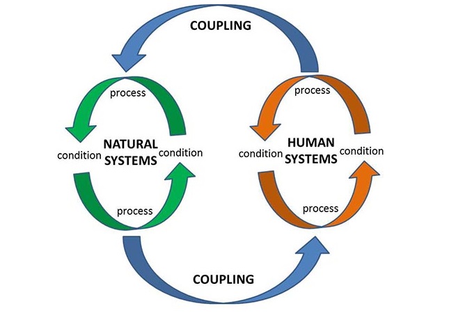
Interactions between the systems are typically dynamic, non-linear and nested. The understanding of coupled natural and human (CNH) systems is critical for evaluating resilience and sustainability of social and eco-systems. To this end, we apply artificial intelligence (AI) and geosimulation methods to quantify dynamic interactions in CNH systems. The modeling results can project land cover change, population movement and eco-system degradation in scenarios of natural disasters and climate change.
Spatial Assessment of Environmental Injustice
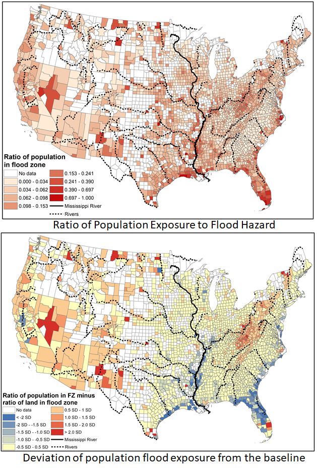
We utilize GIS and spatial analysis to study environmental injustice and social disparities related to disaster risk and urban planning. We conducted national assessment of population and infrastructure exposure to flooding hazards. We also applied GIS to evaluate the unequal share of scenic landscape in Honolulu Hawaii. The goal of these studies are to detect population groups that are disproportionally exposed to flooding hazards, find where they are, and explain the underlying factors.